In short
Start with the places visitors need to find, not every object on the site.
Show their spatial relationship, add a legend and label every entrance.
Check the finished map at phone width because labels can run off the edge.
Keep the source page so a facility move can appear at the same shared address.
NOS Team built a fictional festival site map for this guide. The page has two stages, two entrances, an information tent, an accessible restroom, a food court and a quiet garden. We pasted the page into NOS, worked through Code, View, Share and Edit, then opened the reader link on a phone-sized screen.
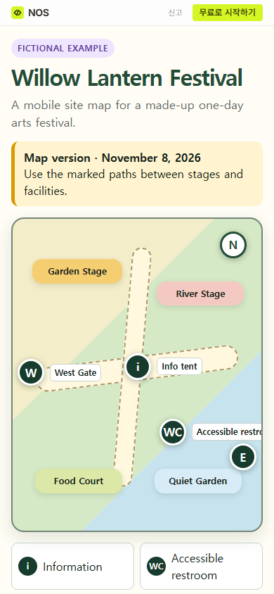
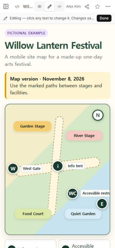
The first phone view exposed a real layout problem: the accessible restroom label extended beyond the right edge. We corrected the label direction, moved that marker beside East Gate and saved the revised HTML on the existing page. Opening the same public address showed the updated notice and marker.
How do you make a festival site map for phones?
1. List the decisions the map must answer
For this example, a visitor needs to choose an entrance, find either stage, locate the information tent and find an accessible restroom. Those places became the map. Decorative objects were left out so the important labels had room.
A site map is different from an event guide. The guide answers what, when and where. The site map shows where things sit in relation to one another. Link the two pages if visitors need both.
2. Build one self-contained page
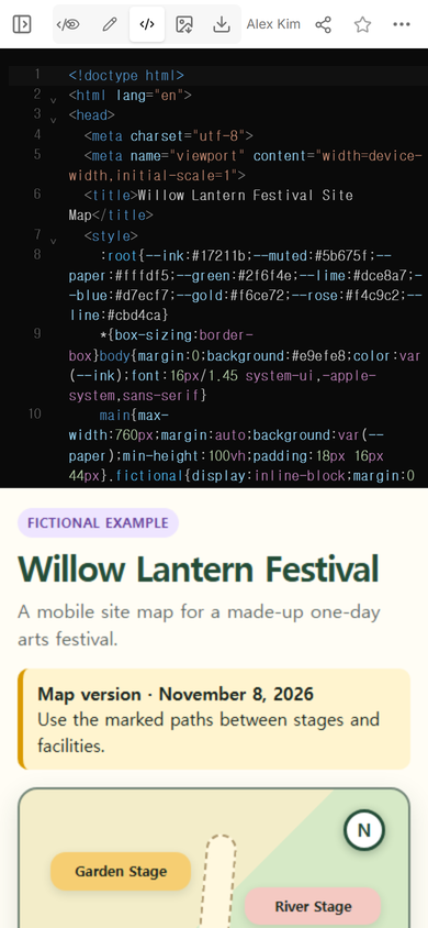
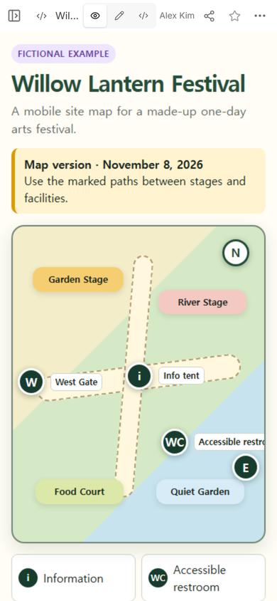
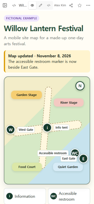
We used colored zones for the two stages, food and the quiet area. Dashed paths cross at the information tent. A north marker fixes the orientation, and W and E identify the two entrances.
Download the complete fictional map example
Open View before sharing. At this stage, check whether the map still has a clear reading order when it is narrow.
3. Create the visitor link
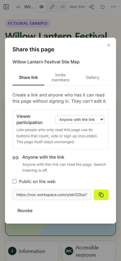
We opened Share and used the viewer link. The panel states that anyone with the link can read this page without signing in and cannot edit it.
The public address opened the fictional map without the editing toolbar. It showed the stages, paths, entrances and legend at phone width.
What should a festival map include?
Use the shortest list that lets a visitor make the next decision. For this fictional site, the working list was entrances, stages, an accessible restroom, information, food and a quiet area. Only include a facility after its position has been confirmed for the real event.
- Orientation: a north arrow or a named edge of the site.
- Entrances: distinct names instead of several identical gate symbols.
- Routes: visible paths between the places people will use.
- Facilities: text labels as well as symbols.
- Legend: every symbol explained in plain language.
- Update note: a visible line when a location changes.
Phone-width tip: place labels inward near the right edge. Our first restroom label pointed outward and was clipped. Turning the label toward the center fixed the problem without shrinking the type.
How do you update a festival site map?
Open the existing page instead of making a replacement. Edit mode shows the rendered page and is useful for checking which item needs attention.
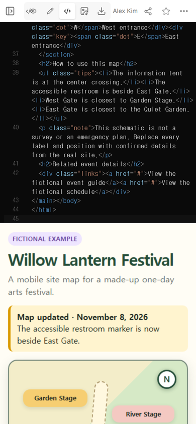
For this example, we changed the page in Code. The updated version places the accessible restroom beside East Gate, turns both right-edge labels inward and adds a dated notice above the map.
View then showed both labels inside the map boundary.
Finally, we opened the original public address again. It showed the updated notice and the restroom beside East Gate.
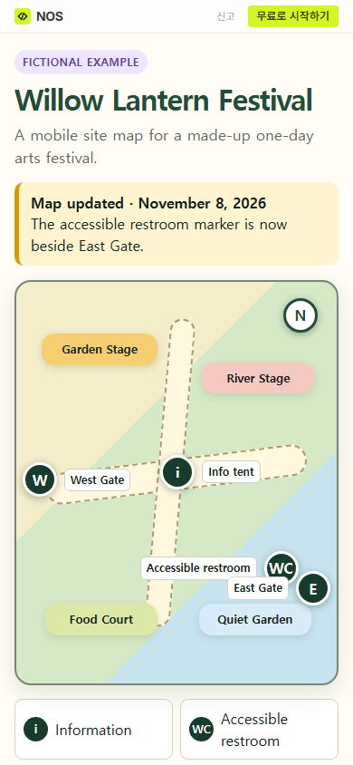
Result: the example now gives a visitor a compact spatial guide, and the shared address displays the corrected phone layout. This verifies the example page and link used in this guide; it does not verify any real venue plan.
Should the map link to driving directions?
A festival site map explains the inside of the grounds. A navigation link gets someone to a real entrance. Keep those jobs separate, then place the confirmed street address and entrance directions beside the site map. The guides to an address link and an HTML map-location link cover that arrival step.
When not to do this
Do not use a handmade schematic as a survey, emergency plan or live crowd system. A large site with changing closures, precise accessible routing or real-time conditions needs a map process owned by the event and venue teams. This example does not track a visitor, calculate routes, reserve facilities or send alerts.
Where NOS fits
NOS lets the organizer paste a complete HTML map, inspect it in View, create a reader link and revise the existing page. In the example above, the same link displayed the later facility change. Check the current pricing page if you need plan details; this guide does not state a price.